
OrbitIndia. Smart satellites with GeoAI on board.
Hyperspectral, SAR and optical sensors on one platform. Delivered as Constellation-as-a-Service and Data-as-a-Service, so you get answers from orbit without owning a satellite.
One satellite. Three ways of seeing.
Together the three sensors show where something is, what it is made of, and what is happening under cloud or at night, in one pass.
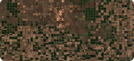
Optical camera
Detail and shape: buildings, roads, field boundaries, change.
Sample: Sentinel-2 true colour. Contains modified Copernicus Sentinel data.
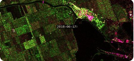
SAR antenna, X-band
Day and night, through cloud and rain: floods, ground movement, ships.
Sample: Sentinel-1 radar. Contains modified Copernicus Sentinel data.
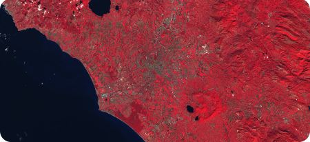
Hyperspectral camera
100+ spectral bands: crop stress, minerals, water quality, oil on water.
Sample: Sentinel-2 infrared. Contains modified Copernicus Sentinel data.
Payload specifications
| Payload | Resolution | Spectral range | Main uses |
|---|---|---|---|
| Optical (pan + multispectral) | ~1–2 m | Visible and near-infrared | Mapping, infrastructure, urban growth, change detection |
| SAR, X-band | ~3–5 m (stripmap) | Microwave, all-weather, day and night | Floods, ground movement, maritime, monsoon monitoring |
| Hyperspectral | ~20–30 m | Visible to shortwave infrared, 100+ bands | Crop health, minerals, water quality, oil spills |
| SpaGeo GeoAI processor | All three | Edge AI in orbit | Detects and classifies on board; alerts and maps downlinked first |
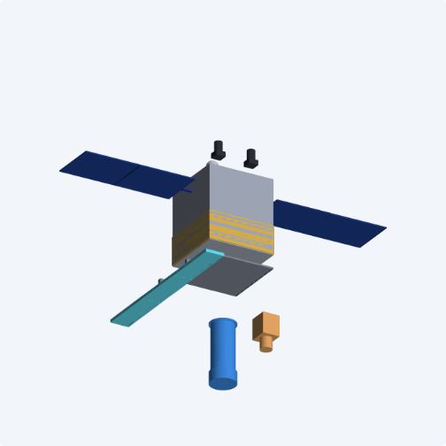
| Mass | ~200–250 kg small satellite |
|---|---|
| Orbit | Sun-synchronous, ~500–550 km; ~15 orbits a day |
| Design life | 5–7 years |
| Revisit | About daily over a country with six satellites |
| Tasking | Area, time, sensor and AI model set from the ground |
| Ground segment | Ground station and mission control; encrypted links |
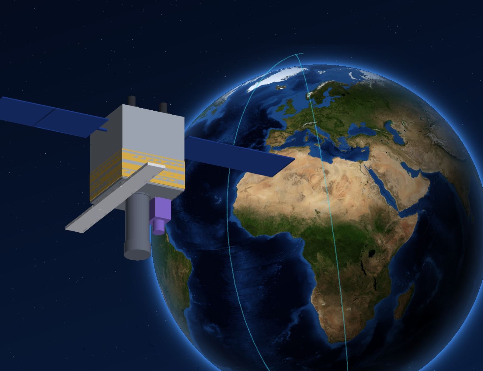
Illustration from the OrbitIndia 3D design model. Performance figures are design targets.
From orbit to answer, in hours
Operators task the satellite from mission control. It captures all three views in one pass, analyses them on board, and sends the answer down first.
Task
Area, time, sensor and AI model, uploaded on the next pass.
Capture
Optical, radar and hyperspectral, through cloud and at night.
Analyse on board
SpaGeo GeoAI detects floods, fires, ships, buildings and crop stress.
Alert and map first
Kilobytes, not gigabytes, straight to responders.
Full images
Follow for deeper analysis on the ground.
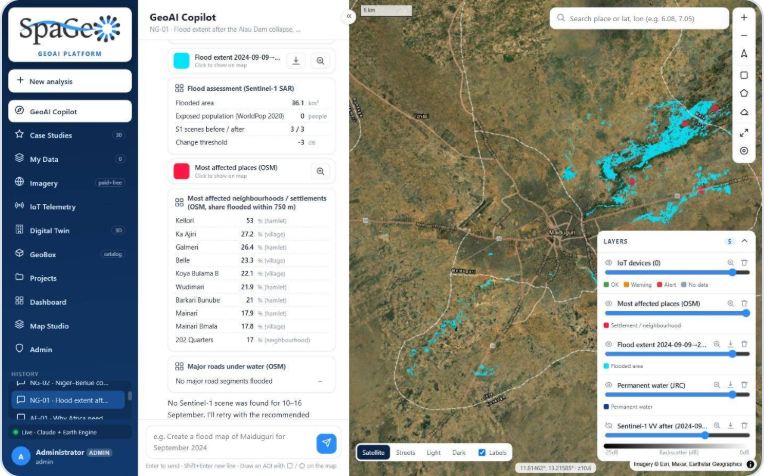
Disaster response: hours, not days
After the Alau Dam collapse, radar mapped 36.1 km² of newly flooded land in Maiduguri through cloud, and ranked the most affected settlements, from one prompt on today's platform.
| Conventional | Order, task, download, process, analyse: often days |
|---|---|
| OrbitIndia | Retask, radar through the storm, on-board AI: within hours* |
*Response within hours is a design goal of on-board processing and rapid retasking.
Your own satellite capacity, without owning a satellite
- Dedicated passes and tasking for one customer or one industry
- You set the priorities; you receive your own data and insights
- No satellite to build, launch or operate
For: governments and space agencies, agriculture, energy, mining, insurance, security.
Ask a question. Get a map.
- Ready-to-use analytics on the SpaGeo GeoAI platform
- Free and commercial data: Sentinel-1 and -2, Landsat 8/9, Planet, Airbus, Maxar
- No downloads and no specialist software; maps, statistics and GIS exports
Built around national priorities
Who we serve
- Concept & design
- Qualification
- Launch
- Commissioning
- First light
- Commercial service
OrbitIndia in motion
For launch, publish this film on YouTube and embed it here for reach and faster loading.
Data pre-orders, dedicated capacity, investment and channel partners
Meet the team at the India Pavilion, ASEICC 2026, Abuja, Nigeria · 24–27 November 2026, or write to us.
OrbitIndia Satellites is an initiative of SPA Geo Technologies Pvt. Ltd. Images: NASA Blue Marble; contains modified Copernicus Sentinel data; SpaGeo GeoAI platform.