

Smart Cities & Land Records
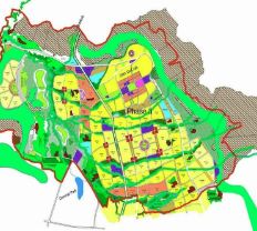
City master plans, property-tax GIS and land management systems from Pilkhuwa to Kabul.
The challenge
Why it matters
Cities collect less tax and plan less well when property records are not tied to a map.
How SpaGeo does it
- Structural and master plans
- Property-tax GIS
- Land management information systems
- 3D city maps
Start a conversation
Planning work in smart cities & land records?
Share a few details and the sector lead will reply within one working day.
Related sectors
Urban Aquifer Management
AMRUT 2.0 aquifer maps for 12 Gujarat cities and shallow-aquifer DPRs for 11 more, from Gangtok to Ranchi.
River Rejuvenation
Drain and river corridors surveyed by drone and echo sounder, with sludge volumes and restoration plans.
Nature-based Solutions (CAMUS-SBT)
Springsheds, wetlands and catchments restored with geospatial evidence and monitored from space.